UN
10 Abbotts Road
£ 345,000
Description
We don't have a Description for this property.
- Bedrooms
- 3
- Bathrooms
- 0
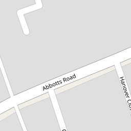

Leaflet © OpenStreetMap contributors
The heatmap indicates the level of crime in the area. The color of the heatmap indicates the crime severity and recency.
Metrics Year-on-Year
- Average area value
- 906,511.00 £Decreased by 10.54 %
- Average area rental value
- 2,414.00 £/moIncreased by 3.03 %
- Est rental Yield
- 3.20 %Increased by 15.52 %
- Crime Rate
- 4.00 %Unchanged by 0.00 %
from 1,013,333.00 £
from 2,343.00 £/mo
from 2.77 %
from 4.00 %
Nearby Schools
| Name | Type | Ofsted | Distance |
|---|---|---|---|
| Cheam Park Farm Primary Academy | Academy Converter | Outstanding | 0.56 KM |
| Cheam High School | Academy Converter | Outstanding | 0.74 KM |
| Cheam Fields Primary Academy | Academy Converter | Good | 0.99 KM |
| Westbourne Primary School | Academy Converter | 1.01 KM | |
| Brookfield Primary Academy | Academy Converter | Good | 1.13 KM |
Images
Nearby Streets
| Name | Average Price | Average Sqft | Distance |
|---|---|---|---|
| The Meads | £ 0 | 0 | 0.00 KM |
| Esher Avenue | £ 587,500 | 0 | 0.00 KM |
| Osprey Close | £ 0 | 0 | 0.00 KM |
| Westbourne Avenue | £ 1,990,000 | 0 | 0.00 KM |
| Stafford Close | £ 900,000 | 0 | 0.00 KM |
Nearby Transport
| Name | NLC | TLC | Distance |
|---|---|---|---|
| West Sutton | 5293 | WSU | 0.93 KM |
| Cheam | 5352 | CHE | 1.63 KM |
| Sutton Common | 5436 | SUC | 1.86 KM |
| Sutton | 5385 | SUO | 2.62 KM |
| St Helier | 5290 | SIH | 2.67 KM |
Nearby Listings
| Address | Price | Type | Score | Distance |
|---|---|---|---|---|
| Chartwell Gardens, Cheam, Sutton, SM3 | £ 230,000 | BUY | Unknown | 0.01 KM |
| Chartwell Place, Cheam | £ 215,000 | BUY | 7 / 10 | 0.03 KM |
| Abbotts Road, Cheam, Sutton, SM3 | £ 325,000 | BUY | Unknown | 0.04 KM |
| Chelsea Gardens, Sutton | £ 325,000 | BUY | Unknown | 0.15 KM |
| Cheam | £ 689,000 | BUY | 6 / 10 | 0.16 KM |
Nearby Properties
| Address | Price | Distance |
|---|---|---|
| 56 Abbotts Road | £ 89,250 | 0.00 KM |
| 42 Abbotts Road | £ 320,000 | 0.00 KM |
| 66 Abbotts Road | £ 154,000 | 0.00 KM |
| 48 Abbotts Road | £ 222,500 | 0.00 KM |
| 40 Abbotts Road | £ 129,000 | 0.00 KM |